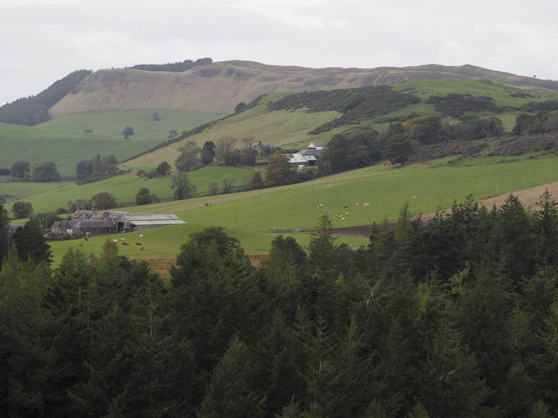
Lundie Craigs, Palmer Hill and Smithton Hill – Left my vehicle in the parking area on the south side of the A923 Coupar Angus to Dundee Road opposite the entrance to Tullybaccart Farm, crossed the road and walked north to and round the side of the farm buildings.
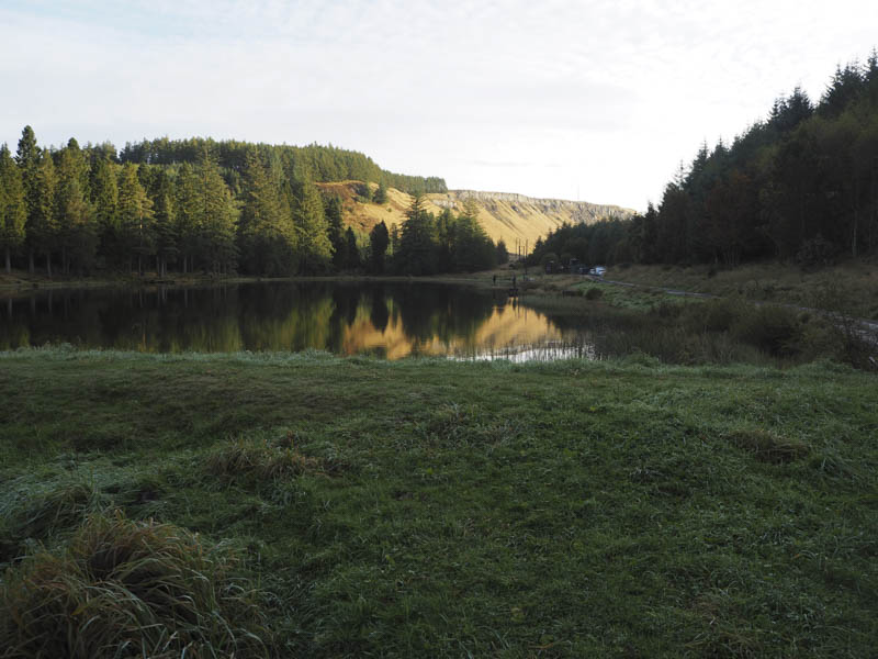
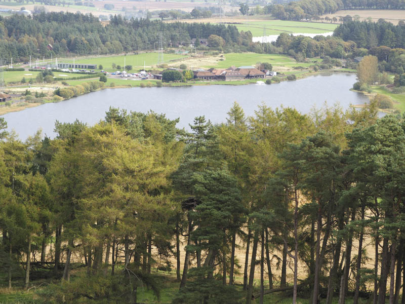
A vehicle track then wound its way through the fir trees of Pitcur Wood leading to Ledcrieff Loch where there were several fishers.
Immediately before the loch another track continued west then north-east initially through more fir trees then mixed woodland. On crossing a stream and at a track junction I took a right, east, and soon emerged from the trees at a set of gates. The track continued to a communications tower but before reaching it I left the track and followed a path to the trig point marking the summit of the Hump, Lundie Craigs.
After a break here sheltering from the wind I descended north, there were a few paths to choose from, before dropping down to the south end of Long Loch where I joined a grassy track. This track led towards Wester Keith Farm but before reaching it I crossed a dyke topped with barbed wire and walked along the edge of grassy field beside Palmer Wood gaining some height.
I entered this wood at a gate where there were some log piles as well as harvesting and extraction machinery. Fortunately it was a Sunday so work to remove the trees was on hold. I crossed some mud covered brash to reach the summit of Palmer Hill. The highest point of this Tump was supposed to be a tree stump but there were now a few to choose from.
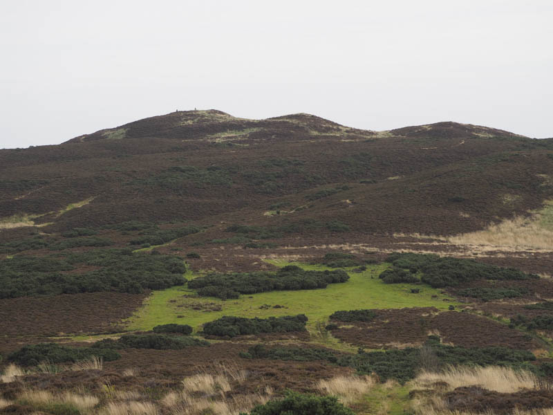
I returned to the grassy track north-west of Wester Keith Farm, crossed it and followed the edge of a copse of trees. I then walked across a field of rough grazing to the fence east of Lundie Craigs where there were traces of a path going south. It was blocked in places by some gorse bushes but on merging with another path it became more obvious. Beyond a stock gate the path headed onto Ardgarth Hill (unclassified) then paths continued south-west to the edge of Pitcur Wood.
After another stock gate I walked south-east through some long vegetation and boggy ground before climbing through heather to the summit of Smithton Hill, the highpoint of this Tump being a grassy, heathery knoll.
The descent west took me to Smith Loch which was more an area of rushes and wet ground. I by-passed it to the south then climbed to the edge of Pitcur Wood where I followed the fence south-west. On reaching what appeared to be a path within the wood I crossed the fence and followed what turned out to be a mountain bike trail. This trail led through the trees emerging onto the vehicle track north of Tullybaccart Farm then I headed back to my car.
Blacklaw Hill West Top and Blacklaw Hill – I left my vehicle at the start of the forest track on the minor road south of the A923 Coupar Angus to Dundee Road accessed from just east of the starting point for my previous set of hills. I then walked south-east along the forest track for around 300 metres to a junction of tracks where I turned left, north-east, and followed a path through fir trees before it descended to the edge of the forest.
The path then headed round the south and west sides of Blacklaw Hill West Top then passed through heather onto the summit of this Tump, a rock beside the path.
Afterwards I descended east and followed one of several paths through a mix of vegetation and onto the Tump, Blacklaw Hill, the highpoint being the trig.
The return was to below the West Top then a path through long grass took me round its east and south sides. It became less obvious before merging with the path coming out of the trees. I then returned though the wood to the start.
Balshando Hill – I parked on the verge of the A923 Coupar Angus to Dundee Road immediately west of the access road to Ledyatt Loch then walked along this track to the loch where there were several fishers. I headed round the east and south sides of the loch and to a padlocked high metal gate between adjoining deer fences. Getting over this obstacle was a bit awkward with no trace of the path shown on the map, not unexpectedly with the high gate and fence preventing reasonable access.
I walked along the edge of a grassy fields separated by an electric wire fence then entered the mixed woodland of Balshando Hill where I walked through some dying nettles and thistles and pushed my way through the tree branches. The highpoint of this Tump was just east of an old bench.
The return was by the approach route.
West Mount Hill – Parked on the south verge of the minor road east of The Neuk, reached from the B954 Muirhead to Newtyle Road north of Auchterhouse, passed through a stock gate and climbed a grassy field holding sheep. Higher up a fence was crossed and I entered the open hillside with its rough grazing and some gorse bushes. There was evidence that cattle roamed here but fortunately there was no sign of them.
The trig point was reached with the actual highest point of this Tump being within 10 metres of this construction. The return was by the ascent route.
- Time taken – 7 hours.
- Distance – 19.5 kilometres.
- Height climbed – 655 metres.