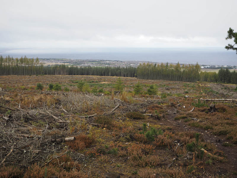
Old Fir Hill – Located north-east of Keith this Tump was climbed from the single track road to the north. Parking at the side if this minor road near the start of the vehicle track east of Rosebank wasn’t possible but I did located a spot around 600 metres to the east. I walked back to the vehicle track then headed south to a locked stock gate where I could have left my vehicle.
The track continued south through the forest some of which had been harvested and new trees planted. After over two kilometres I came to another area where the mature trees had been replaced by younger ones and decided that this was the point to leave the track and locate the summit of Old Fir Hill. I crossed some brash then walked up a heather covered break but as I closed in on the summit the area consisted of young firs around six feet in height.
I located a large clump of heather which appeared to be the highest point of Old Fir Hill before returning by the upward route.
Hill of Maud – This Tump was located to the south-east of Buckie. I left my car at the start of the forest track accessed along a minor road to the south-west and walked up this track. At the final bend a wet path headed through some young trees to an area that had been harvested. At a junction of paths I went right as the path headed round the Hill of Maud until reaching trees that hadn’t been cut down. Here a path led up the side of the mature trees where numerous ones had been blown over. The path later led into the forest and to a small circle of stones marking the summit of this Tump.
I continued along the path which soon emerged from the trees into the cleared area. Another path through the brash rejoined the upward route and I returned to the start.
Little Bin – Located to the south of Portnockie this Tump was climbed from the minor road to the south. There were no spaces left at the entrance to the forest track as this point was also the start for the ascent of the Marilyn Bin of Cullen. I therefore parked at the edge of a passing place and walked back west to the locked stock gate. The forest track initially dropped to the crossing of the Glen Burn via a bridge.
Beyond at a junction of tracks I took a left and climbed north-west to the col between Bin of Cullen and Little Bin. Here I left the track and crossed rough ground mainly consisting of heather and trees, some stunted, to reach the cairn on Little Bin. The actual highest point was apparently ground 10 metres to the south-south-west.
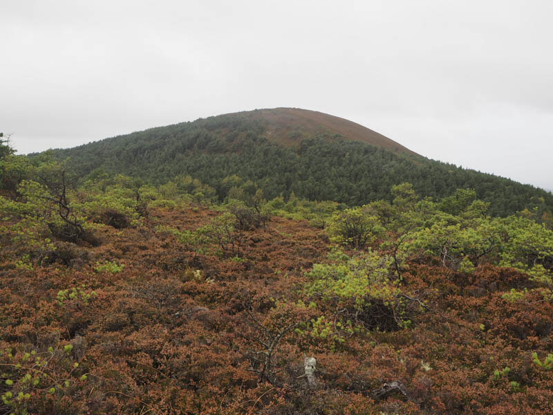
The return was by the ascent route as heavy rain commenced.
- Time taken – 3.75 hours.
- Distance – 15.25 kilometres.
- Height climbed – 350 metres.