Ordiquhill – On a previous visit I failed to find a route onto this Tump but with more information I parked on the west side of the B9022 Huntly to Portsoy Road at the start of one of the several forest tracks leading into the Bin Forest. (NJ528429)
I walked north-west along this forest track to a crossroads junction (NJ526434) where I took a left, south-west, along a lesser used track at the edge of a felled area. This track then headed west between mature fir trees and a younger plantation and became a bit overgrown with the vegetation wet from overnight rain. I was on the lookout for a route through the young trees onto Ordiquhill but there was nothing obvious.
The track turned north-west so at NJ518431 I was left with little option but leave the track and climb through the trees which were well above my height. The underfoot conditions were awful with long wet vegetation, hollows and some old brash. I was soon soaked from pushing my way through the wet branches. Eventually I reached a small clearing where the trig point was located although the highest point of this Tump was five metres away amongst the long wet vegetation.
I looked around for an easier route off the summit but there was nothing obvious so I re-entered the trees and worked my way back through them re-joining the track 200 metres north of where I had left it. I then returned to the start by the approach route.
Gallow Hill – This Tump was located north of Davach of Grange on the A95 Keith to Banff Road. I left my car at the entrance to an old quarry on the minor road north of Rhu Lodge and walked briefly south along this road to the start of a vehicle track that headed west then north round the top of the quarry.
I left this track, crossed a barbed wire fence, and walked through the well spaced trees to the summit of Gallow Hill. Despite wandering around I never came across the moss covered stones which apparently marked its highest point.
The return was by the ascent route although I discovered and used a tidied down stock gate in the barbed wire fence.
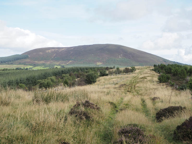
Sillyearn Hill –The next Tump I planned to climb was located to the west of the A95 Keith to Banff Road and north-east of the above Gallow Hill. I drove to the minor road north of Little Fortry and parked at a bend there then walked north-east along the farm track to the property at Oakenknowes.
A lesser used track was then followed south-east up the edge of a forest crossing what was left of Bowman’s Road, not a lot. I then continued up the east side of a deer fence through long wet vegetation, later crossing this fence and heading south-west along the edge of another forest area through more long wet vegetation and trying to keep out of a ditch.
At the edge of this section of forest there was another change of direction as I climbed south-east onto Sillyearn Hill coming to a vehicle track running across the hillside from north-east to south-west. I walked south-west along this track before leaving it and entering the young trees and heather. It was difficult to tell where the exact summit of this Tump was.
I returned to and along the track looking for an easier route back to my car. I descended north-west along the side of another plantation of fir trees where the going was a bit easier. However lower down the underfoot conditions were pretty awful as I followed a deer and stock fence through long rough vegetation and some hollows. Eventually I reached the vehicle track near where I had left my car.
Lurg Hill – My final hill of the day was the Hump, Lurg Hill. I left my vehicle beside the reservoir west of Croylet, located east of the B9018 Grange to Cullen Road, and walked north along an old vehicle track crossing a tied down gate. This track soon joined one coming in from the south-west which was still in use. The track continued north through the trees skirting a wind farm to the east and the ruins at Loanhead of Myretown to the west.
Beyond there was an old quarry and here the track split, one route going west and the other, which I followed, north-east. This track continued through the forest where the lower branches of the mature fir trees had been removed and left at the side of the track.
On reaching the end of the forest and the track I came to a new deer fence and gate. Beyond, young saplings had been planted and the ground appeared rough. I therefore walked east along the edge of the deer fence then north between the deer fence and a stock fence. This narrow gap had been used while building the deer fence and was a bit rough and wet in places but better than the alternative. I later crossed the stock fence and visited the summit of Lurg Hill, some heather seven metres to the east.
I had noted that there was an alternative highpoint so headed north through the heather, re-crossed the stock fence beside a communications tower and walked along the edge of the new deer fence. I later left it and entered the Lurghill Plantation but despite wandering through the trees pushing aside the branches the alternative highpoint wasn’t obvious.
On returning to the deer fence I followed it back to the gate then used the approach route back to Croylet.
- Total time taken – 4.25 hours.
- Total distance – 11.5 kilometres.
- Total height climbed – 365 metres.