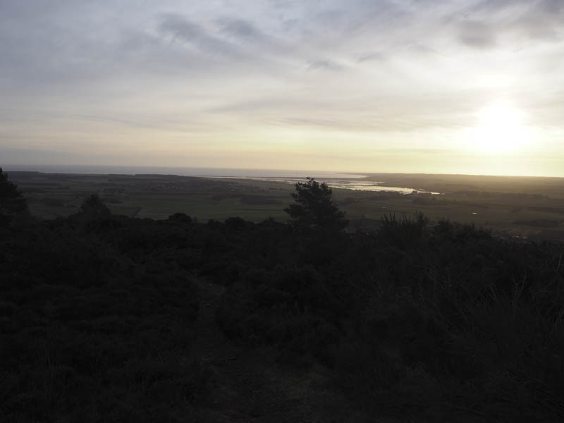
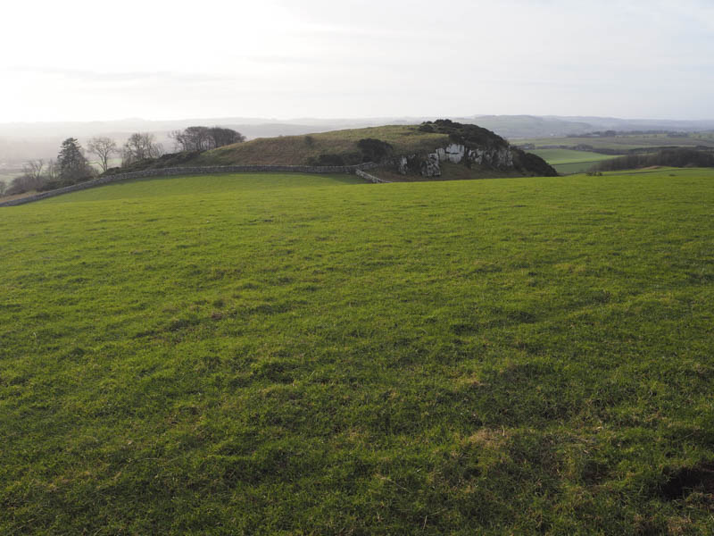
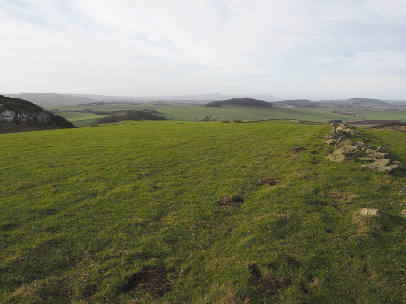
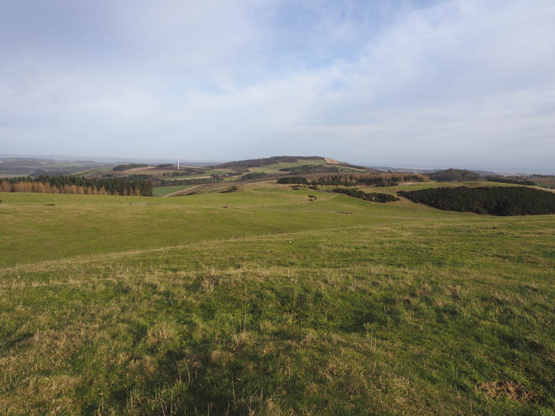
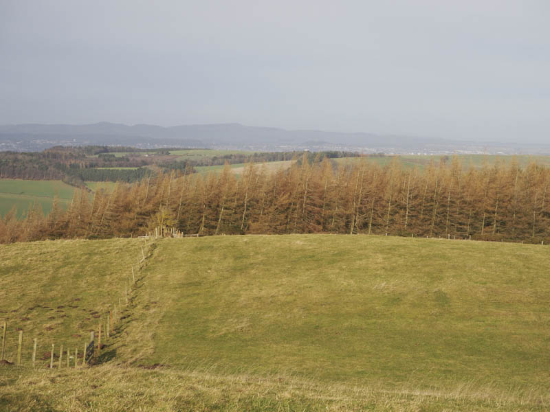
Lucklaw Hill – Parked in School Road, Balmullo, located immediately west of the A941 Newport on Tay to Cupar Road and walked west along the single track Quarry Road later leaving it and entering a grassy field to the east of Lucklaw Hill. It was a steady climb to a second gate and beyond it a stone chippings and earth vehicle track which led to and above the top edge of a large quarry. There were a few short paths through gorse, heather and broom to pick from to reach the summit of this Hump. The highest point was the cairn SSW of the trig point which was obviously lower.
I then retraced my route.
Airdit Hill – After Lucklaw Hill I drove west along Quarry Road, Balmullo, (not advised due to the potholes) to the hamlet of Logie parking on the grass beside the phone box there. I walked briefly south along the road, entered and crossed a stubble field, then through some rough grass to reach a fence surrounding woodland. Once over this fence and after a short climb I came across some tracks which took me passed cut logs, an old lamp post, and close to the summit of Airdit Hill. The highest point of this Tump was close to the edge of a small quarry. There was a wooden house to the south of the wood.
The return was by the approach route.
Craigsanquhar – From Logie (see above for Airdit Hill) it was a short drive south-west on a single track road to an obvious left hand bend parking on the verge there. I crossed a stock gate and walked north along a vehicle track for several metres before going over a second gate and entering a field containing sheep then climbing to the grassy summit of the Tump, Craigsanquhar.
There was an alternative summit to the south so I descended south-west, crossed a barbed wire fence, the vehicle track and a stock gate to enter another grassy field containing sheep. From there I climbed towards this highpoint, going over a barbed wire fence and into some trees and to a small cairn which appeared to mark the summit.
I returned across the fence and followed it east to a double stock gate and my car.
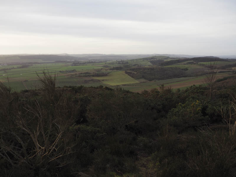
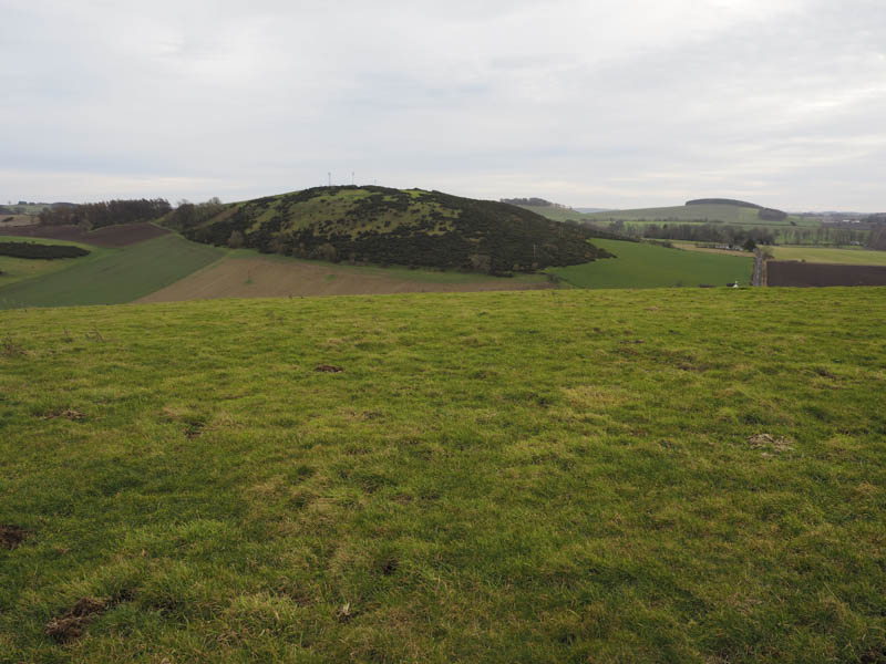
Craigfoodie Hill – This Tump was located west of the A941 Newport on Tay to Cupar Road and north-west of the hamlet of Dairsie. I parked on the south verge of the minor road to the north beside the entrance to a stubble field. I entered this field and followed a stone dyke before descending south-east to a second dyke. Once across it I was into a grassy field but a direct ascent to the summit of Craigfoodie Hill wasn’t possible due to gorse bushes. I walked round this obstacle to the east and to a farm track which was briefly followed before making a beeline up the grassy hillside to the highpoint of this Tump, some grass beside the remnants of an old stone dyke.
The nearby hill Craiglug was apparently the same height so I descended south, crossed a stone dyke and into grassy tussocks and to the summit which was marked by a small cairn amongst gorse bushes.
I returned to and went over the dyke then headed directly back to the stubble field and my car.
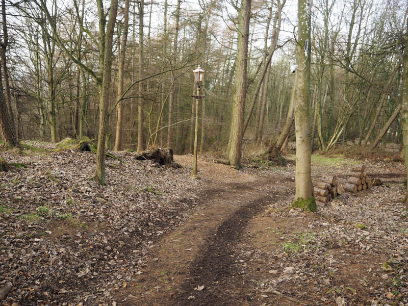
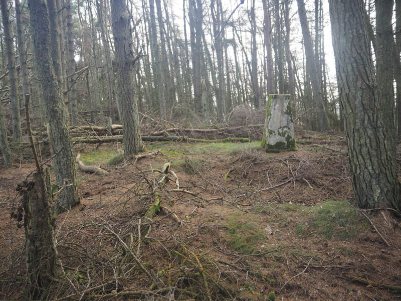
Myrecairnie Hill and Kedlock Hill – These two hills were located west of the unclassified Cupar to Kilmany Road, north of Cupar. Parking was a problem so I left my car at the side of the minor road to the east and walked south to the start of the access track for Myrecairnie Farm. I headed along this track to its first bend then continued west, crossed three stock gates, went alongside the edge of a grassy field and over another gate to enter a field containing a winter crop. The edge of this field was briefly followed before I crossed a fence and entered the wood containing some fallen trees. Here I located the trig point marking the summit of the Tump, Myrecairnie Hill.
I returned to the crop field and walked east then descended north along its edge to reach a stubble field which was crossed to reach another wooded area. I climbed through the well spaced trees to a small knoll which was the highest point of the Tump, Kedlock Hill.
The descent south took me out of the trees and back into the stubble field then I headed south-east across this field and onto a muddy track that led to the minor Cupar to Kilmany Road a short distance from my car.
Forret Hill – This hill was positioned to the east of the unclassified Cupar to Kilmany Road south of Kilmany.
I parked on a muddy area at the east side of the road, crossed a stock gate and walked east along a vehicle track to another gate with a warning sign regarding a bull. This muddier track ran below some gorse bushes gradually gaining height and later with deep muddy gouges. I left this track and headed north-east towards the summit of Forret Hill through some stony ground, gorse bushes and across grass. The summit of this Tump was a pile of stones but was located on the other side of electric and stock fences. I was able to crawl under the electric fence then over the stock fence to reach the highpoint.
The descent was initially south to an open gate then I returned to my car via the upward route. There was no sign of the bull or any cattle.
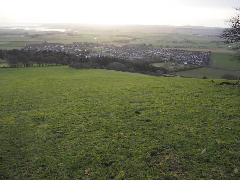
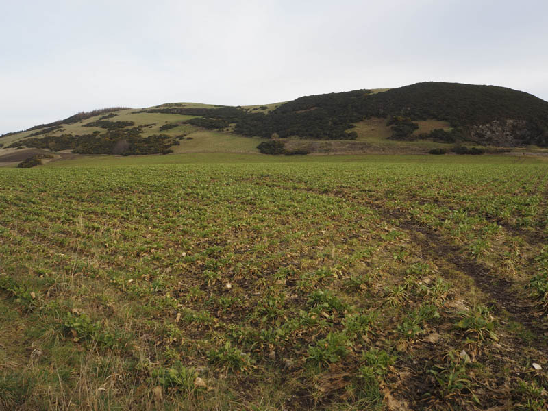
Darklaw Hill – This Tump was located to the south of the A92 Dundee to Glenrothes Road and immediately above the hamlet of Rathillet. I left my car here although there was limited parking and walked north-east, crossed a stock gate, and followed a vehicle track south-east then a cattle trod east below gorse bushes and Darklaw Hill. It took me a while to find a route through the gorse, and then it was a steep climb to a barbed wire fence. Once over it I walked to the highpoint which was amongst some gorse bushes to the south of a communication tower.
The descent was initially south-west then I re-crossed the barbed wire fence and came across an old track obviously used to construct the communications tower. This track wound its way south-west and once below the gorse bushes I cut across the grassy field to the gate at Rathillet.
North Hill – The penultimate hill of the day was north of the A92 Dundee to Glenrothes Road and the hamlet of Rathillet. I parked on the verge on the south side of an old railway bridge to the west of North Hill, walked under the bridge then left the road onto a vehicle track which crossed the Motray Water via a bridge into a stubble field. I soon left this field, crossed the dismantled railway line going through a couple of open gates and onto the grassy hillside containing a few gorse bushes. It was a steady climb to reach the highpoint of the Tump, North Hill, which was some grass.

I then retraced my route.
Round Hill – The previous month I had attempted to climb this Tump from the north but the field surrounding it contained a winter crop so this time I was looking for a route from the south. On the north side of the A92 Dundee to Glenrothes Road, opposite the hamlet of Kilmany, a vehicle track headed off to the north. I initially planned to park at the side of this track but there was no obvious spot so I took a chance and drove north then west passed a wind turbine parking beside a small quarry. It was a short walk to a gate in the deer fence and into an area where the trees had been harvested and new ones planted. It was rough awkward walking to reach what appeared to be the highest point of Round Hill. I then returned to my car and fortunately on the drive out I didn’t meet anyone.
- Total time taken – 4.5 hours.
- Total distance – 13.5 kilometres.
- Total height climbed – 780 metres.