Chester Hill – After crossing the Tay Road Bridge I continued briefly south on the A92 before turning left and driving east along a single track road containing numerous potholes. There was limited parking but I did manage to get my car off the road, just, at a bend between Washer Willy’s and the Scotscraig Burn.
I walked back along the road for around 200 metres, which covered around half the distance to the summit of Chester Hill, where there was a Right of Way sign for Causewayhead and East Newport. On passing through an unstable wicket gate I headed along the edge of a grassy field to another wicket gate, which was in better condition, and entered the woodland. A short walk along a track then on logging vehicle marks led to a cleared area where the highpoint of this Tump appeared to be beside the stump of one of the logged trees. I then retraced my route back to the start.
Craig Law and Hare Law – On returning to my vehicle I drove a short distance east to the access road for Scotscraig Estate parking at the wide bellmouth. I passed through a stock gate and walked north-east soon leaving this road and entering a grassy field via another stock gate. I crossed this and a second field before entering the woodland where there was some rough underfoot conditions, including brash and fallen trees although they weren’t much of a problem. The summit of the Tump, Craig Law, was a grassy flattish knoll.
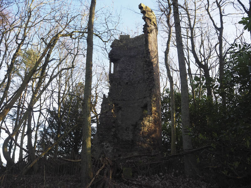
From there I descended north-east, the underfoot conditions were rougher here, to reach a barbed wire fence at a junction of tracks. Once over this fence and track I climbed a wooden and wire construction, part of another fence, and entered an area of woodland where occasionally there were some old tracks. It was an easy climb north with a couple of undulations to reach the summit of Hare Law and the ruin of Waterloo Tower. This would have been a good viewpoint out over the Firth of Tay if it hadn’t been for the trees. The highpoint of this Tump was beside the tower and within the fence which had collapsed.
I returned to the junction of tracks then south along one of them back to the start.
Knock Hill – This Tump was located east of the A92 Dundee to Glenrothes Road and south of the roundabout at the junction with the A914. Stopping wasn’t permitted on the A92 so I took a chance and drove a short distance east along the private road to just beyond no access signs and left my car on a grassy area.
I walked along the private tarred road, passed a walled garden, to just after a cottage. At a barrier across the vehicle track I entered the open woodland and commenced the ascent of Knock Hill. There were a few fallen trees but it was an easy walk, mainly on a bed of leaves, to the summit of this hill which was marked by a few stones beside a tree. I then retraced my route.
St Fort Hill – This hill was located to the west of the A92 but as mentioned above there was no stopping permitted on this busy road. I therefore had to look for an alternative approach route and parked at the end of the cul-de-sac in Ericht Road, Wormit. Here there was a Right o Way sign for St Fort, the lower section of this path being closed off for some reason.
I walked north along this path and when it merged with a vehicle track coming in from the west I crossed a couple of stock gates and headed east over a grassy field to a well maintained stone dyke. Once over it into another grassy field I walked south-east to a short section of wooden and wire fencing, a gap in a further stone dyke, and this took me into woodland where a path led to a Scotways sign. The summit of the Tump, St Fort Hill, a mossy boulder, was to the north beside some fallen trees.
On returning from the wood into the grassy field I walked round the first stone dyke I had encountered and followed it west squeezing through gaps to the south of a couple of fences to re-join the Right of Way which was followed back to the start.
Scurr Hill – The starting point for this Tump was the hamlet of Kirkton, located just above the Firth of Tay and to the west of Wormit. The streets here were narrow with very limited parking although I found a spot near the T junction on entering the village but it may have been a householder’s parking space.
I walked across this junction and entered a stubble field where I headed east and into the woodland where I joined a path which led to the summit of Scurr Hill. The highest point was a grassy mound to the south of the path and below some tree branches. I then returned by the approach route.
Shambleton Hill – I parked in Crawford Avenue, Gauldry, and walked south-east along a lane passed a few houses onto a vehicle track. This track later became a bit muddy and waterlogged but took me to the line of trees east of Shambleton Hill. A path through the well spaced trees led to the summit of this Tump, ground to the south of the track.
I continued west along the path which later joined another path running north to south. I walked south here but the track soon turned east running below Shambleton Hill. I was planning to climb the Tump, Round Hill, to the south, but the mapped path and track to its west didn’t exist. A winter crop was growing in the field around this hill so it wasn’t practical to climb it. I therefore continued along the path below Shambleton Hill rejoining the vehicle track just south of the point I had left it earlier. I then headed back to my car.
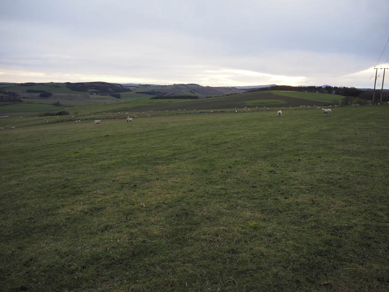
Newton Hill – I moved my car to the east end of Crawford Avenue in Gauldry parking beside the signpost for Sandford. This path passed between a couple of houses then stock fences to reach Brownie Wood. A winding path through the woods led to a grassy field then below the north side of Gallow Hill. On entering a third grassy field I was aware that it was best to be on the south side of a double barbed wire fence so I crossed a couple of stock gates and entered a field containing sheep. Initially I walked along the side of the fences later leaving them and heading for the grassy summit of the Tump, Newton Hill. I then retraced my route.
- Total time taken – 5 hours.
- Total distance – 16 kilometres.
- Total height climbed – 460 metres.