Spital of Boleskine – With the forecast for thundery showers in the afternoon I decided on a couple of hills on the east side of Loch Ness north of Foyers. The first one was the Spital of Boleskine so I left my vehicle in the Forestry Scotland car park at Farigaig on the south side of the minor road just off the B852 Dores to Foyers Road.
I walked south-west, initially it was a steady climb on a path marked Farigaig Circular and footpath to Foyers, Stratherrick and Boleskine. The gradient later eased as it joined a vehicle track coming in from the east with now an easy walk through the mature forest. A fallen tree blocked the route but an archway had been created for walkers and cyclists.
On reaching and going under power lines I left the track (NH51412270) and climbed steeply east on a rough path through wet bracken, flowering broom and small firs to a pylon. Here a vehicle track continued east so I followed it, gaining more height although this was taking me away from the summit area. At the next pylon and the highpoint on the track (NH51792274) I left it and headed briefly south then south-west through trees of various heights and ages. Underfoot was pretty awful with fallen trees, brash and moss covered rocks concealing hollows making for very slow progress especially through the low branches. There were some small animal trails but they were of little use.
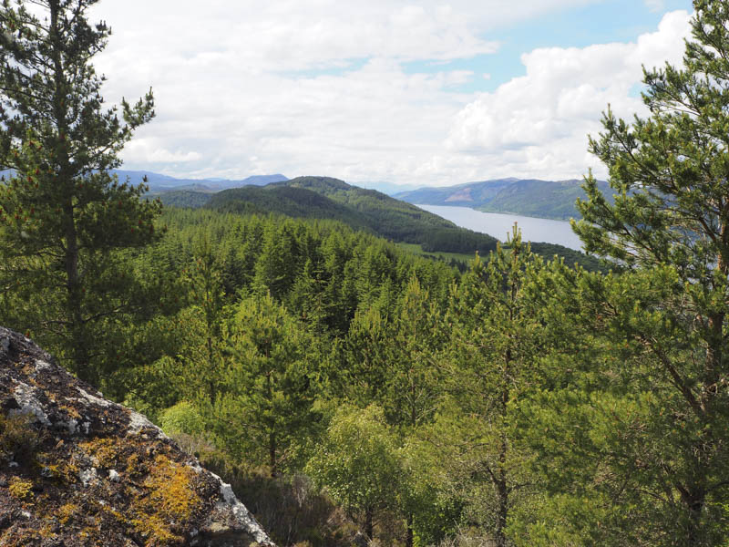
Eventually I reached a small clearing and the summit of the Tump, Spital of Boleskine , an outcrop, with good views to and across Loch Ness. Unfortunately my camera was over exposing so no photos.
After a coffee break surrounded by a few midges I initially descended by the approach route before continuing north through the trees. This appeared a bit easier until just before reaching the power line track (NH51592272) where I was confronted by numerous fallen trees. This took a while to figure out a route round or across them. On reaching the track I returned to the car park by the approach route.
- Time taken – 2 hours 5 minutes.
- Distance – 4 kilometres.
- Height climbed – 200 metres.
Creag a’ Ghiubhais – I parked at the start of a vehicle track on the east side of the B852 Dores to Foyers Road just south of Boleskine Cemetery, crossed a padlocked gate, and walked south up vehicle track to its first bend where an old caravan was parked.
Here I left the track, climbed a small embankment and crossed a field of long grass to reach a stock fence topped with barbed wire. Nearby a tree had fallen and broken the top wire so it made for an easier crossing. I then headed up through the trees, there were a few fallen ones, and over moss covered boulders to reach a forest track. I decided against using the track and continued uphill with similar underfoot conditions until I reached the track again which had wound its way up the hill.
I followed the track to a junction where I went left (I presume the other track led to the enclosure I came across) but the track soon came to an end at NH50752146. I then crossed more rough ground to an enclosure surrounded by a high fence topped with barbed wire. Apparently the highest point of the Tump, Creag a’ Ghiubhais, was a rocky mound within the enclosure.
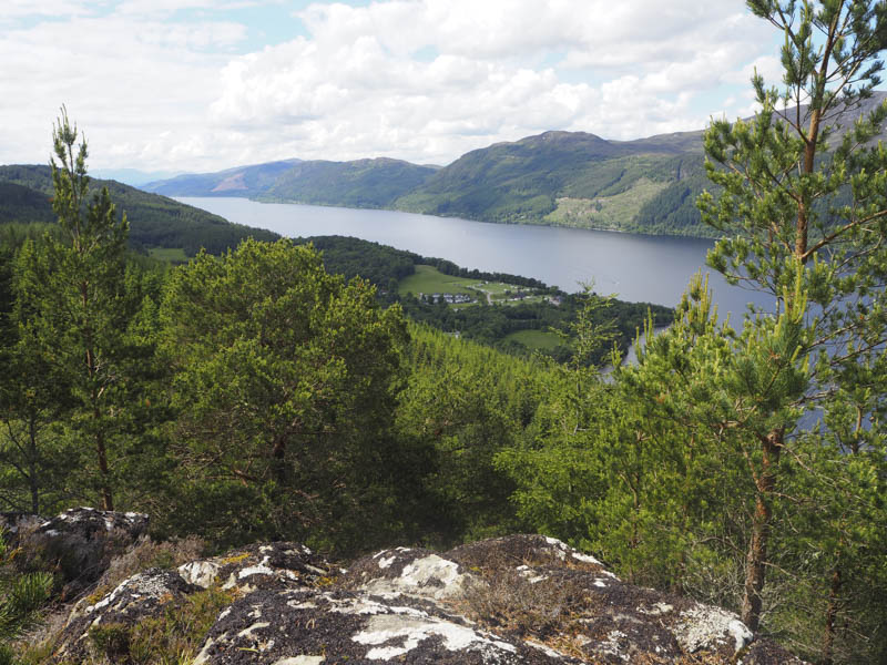
Apparently there was an alternative summit to the SSW so I made a short descent through the trees and more of the same rough ground followed by an easy climb to a cairn on an outcrop where I had views down to Foyers and Loch Ness.
I returned to the track and used it on the descent. Lower down, as the track continued south-west away from my starting point, I came across an old unused track which led to a gap in the fence. (the old gate was lying at the side) I crossed the grassy field and headed back to my car.
- Time taken – 1 hour 25 minutes.
- Disatnce – 2.5 kilometres.
- Height climbed – 220 metres.