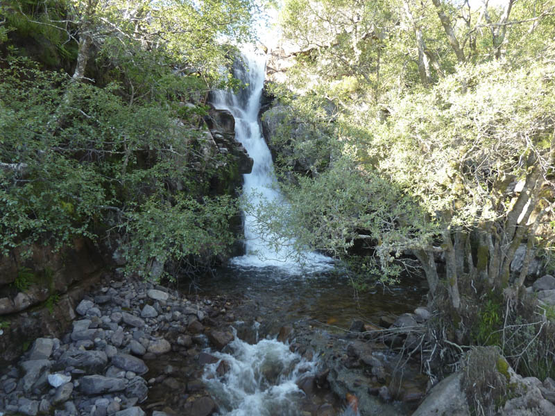
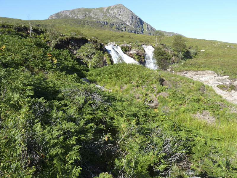
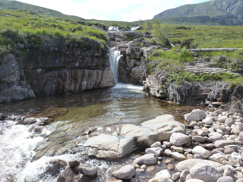
It was a fine sunny morning when I parked up on the west side of the bridge over the Allt Airdeasaidh, on the A832 Braemore Junction to Poolewe Road. I re-crossed the bridge and walked up the rough, rocky and at times boggy path on the east side of this stream with views of the numerous waterfalls.
![Allt Airdeasaidh from bridge A832](https://scotlandhills.net/wp-content/uploads/2021/04/01-Allt-Airdeasaidh-from-bridge-A832.jpg)
![Sail Mhor and waterfalls](https://scotlandhills.net/wp-content/uploads/2021/04/02-Sail-Mhor-and-waterfalls.jpg)
![Little Loch Broom](https://scotlandhills.net/wp-content/uploads/2021/04/03-Little-Loch-Broom.jpg)
![Across Little Loch Broom to the hamlet of Badrallach](https://scotlandhills.net/wp-content/uploads/2021/04/04-Across-Little-Loch-Broom-to-the-hamlet-of-Badrallach.jpg)
![Little Loch Broom and Beinn nam Ban](https://scotlandhills.net/wp-content/uploads/2021/04/05-Little-Loch-Broom-and-Beinn-nam-Ban.jpg)
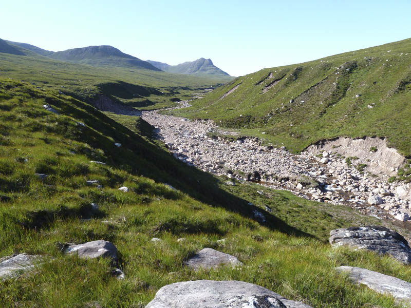
Beyond a narrow gorge the gradient eased as the path continued up the east side of the Allt Airdeasaidh. There had been some erosion since my previous visit with a section of the path washed away.
![Erosion Allt Airdeasaidh](https://scotlandhills.net/wp-content/uploads/2021/04/06-Erosion-Allt-Airdeasaidh.jpg)
I crossed the stream, went up a steep banking, then through rough ground consisting of a mixture of vegetation and rocks, to reach the foot of the east face of Sail Mhor.
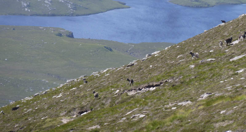
The gradient then steepened as I climbed a narrowing gully of heather, stones and scree with a number of paths, possibly animal tracks, to choose from. Higher up there was a distinctive smell of what I later discovered was goat and here it became less steep. It was then an easy walk to the cairn marking Sail Mhor’s South-East Top.
![Camusnagaul and Beinn nam Ban](https://scotlandhills.net/wp-content/uploads/2021/04/07-Camusnagaul-and-Beinn-nam-Ban.jpg)
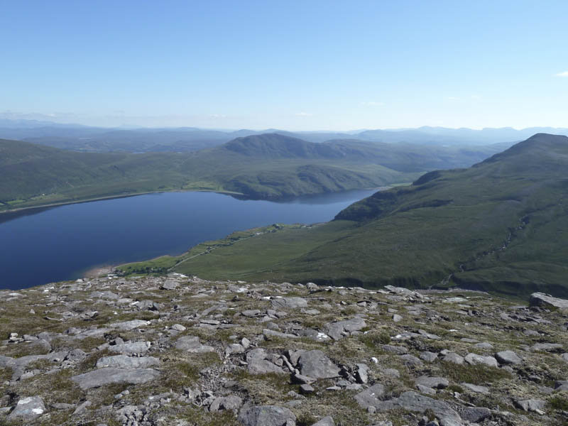
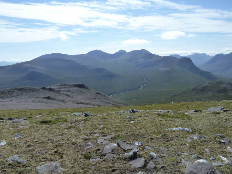
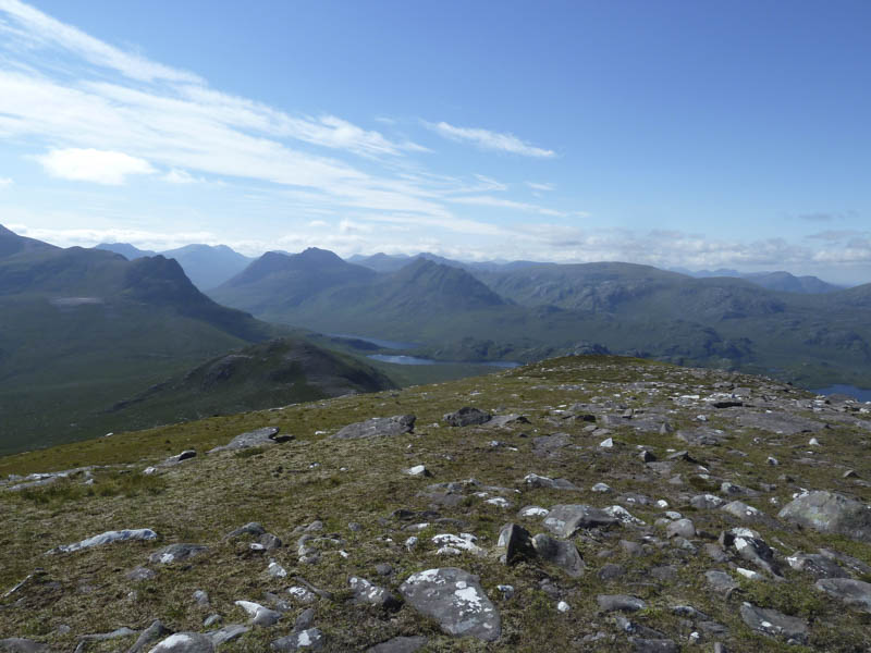
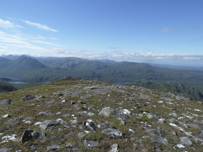
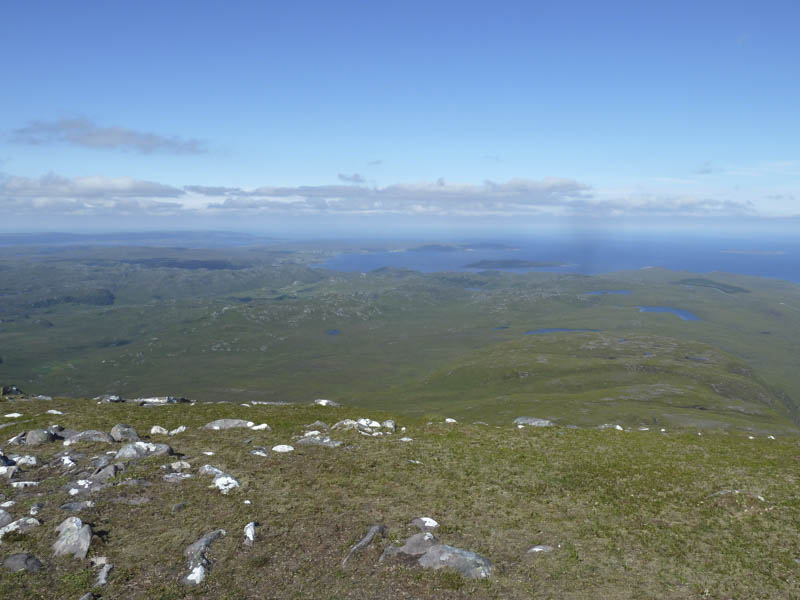
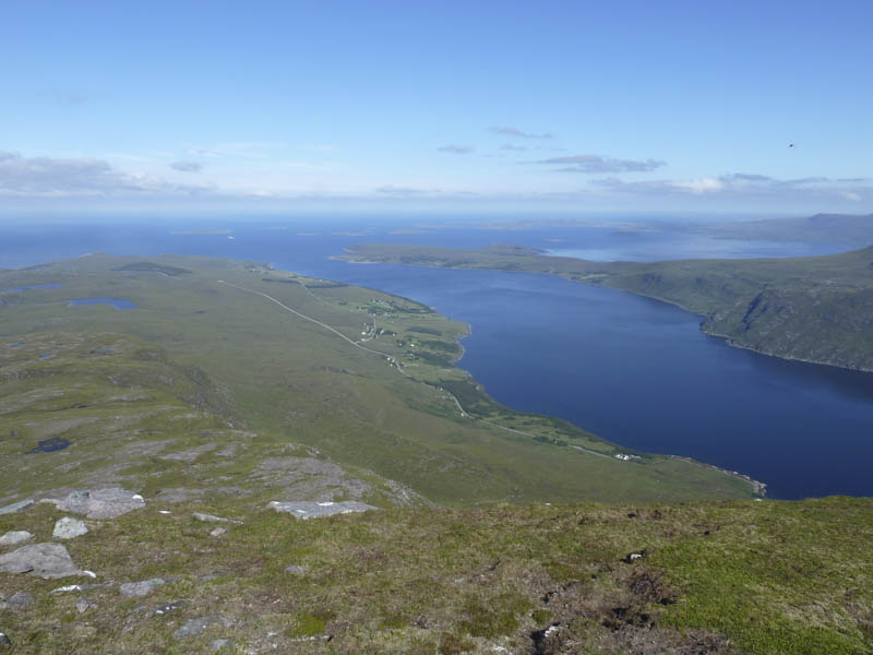
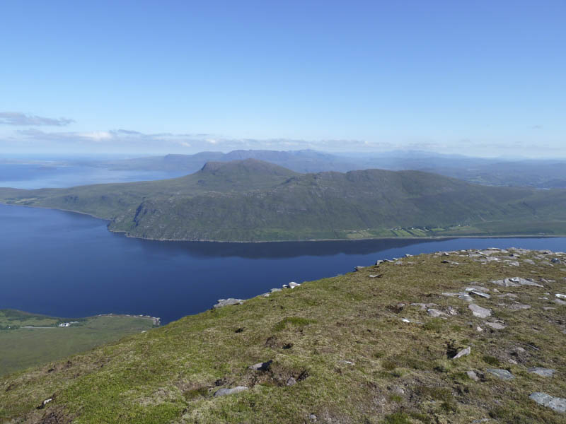
A short descent was followed by an easy climb through a mixture of stone and vegetation to reach the shelter on Sail Mhor. The cairn marking the summit of this Corbett was a bit further west. I spent some time up here as the views were superb.
![Cal Mac Ferry leaving Loch Broom](https://scotlandhills.net/wp-content/uploads/2021/04/08-Cal-Mac-Ferry-leaving-Loch-Broom.jpg)
![An Teallach](https://scotlandhills.net/wp-content/uploads/2021/04/09-An-Teallach.jpg)
![Beinn Dearg Mor and Beinn Dearg Bheag](https://scotlandhills.net/wp-content/uploads/2021/04/10-Beinn-Dearg-Mor-and-Beinn-Dearg-Bheag.jpg)
![Beinn a' Chaisgein Mor and Beinn a' Chaisgein Beag](https://scotlandhills.net/wp-content/uploads/2021/04/11-Beinn-a-Chaisgein-Mor-and-Beinn-a-Chaisgein-Beag.jpg)
![Laide, Gruinard Bay and Gruinard Island](https://scotlandhills.net/wp-content/uploads/2021/04/12-Laide-Gruinard-Bay-and-Gruinard-Island.jpg)
![Badcaul, Little Loch Broom and Scoraig](https://scotlandhills.net/wp-content/uploads/2021/04/13-Badcaul-Little-Loch-Broom-and-Scoraig.jpg)
![Beinn Ghobhlach with Ben More Coigach beyond](https://scotlandhills.net/wp-content/uploads/2021/04/14-Beinn-Ghobhlach-with-Ben-More-Coigach-beyond.jpg)
The descent took me through a wide gully between the South-East Top and the summit and here I disturbed a large herd of feral goats.
![Feral Goats](https://scotlandhills.net/wp-content/uploads/2021/04/15-Feral-Goats.jpg)
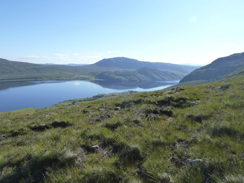
I then walked below the east side of Sail Mhor before descending through rough vegetation to reach the west side of the Allt Airdeasaidh gorge. There were traces of a path and from this side the views of the gorge and waterfalls were better.
![Allt Airdeasaidh on descent](https://scotlandhills.net/wp-content/uploads/2021/04/16-Allt-Airdeasaidh-on-descent.jpg)
Lower down the path became more obvious but it was also boggy in places with the final section involving some down climbing although there may have been an easier route a bit further west.
- Time taken – 4.5 hours.
- Distance – 7 kilometres.
- Height climbed – 760 metres.